A passing storm brings mountain snow and lowland rain today. It won’t be raining all the time, but it will be soggy enough that you’ll want some rain gear handy as you go about your day.
Plan Your Wednesday
Rain and mountain snow move through the region today. The steadiest rain will be during the midday hours. By the afternoon, the rain will be in the form of scattered showers. It will only rain for a few minutes at a time with some partly cloudy conditions in between the downpours. A couple of lightning strikes around the region are not out of the question. Winds will be breezy in the afternoon, with gusts reaching 30 mph across the Columbia Basin.
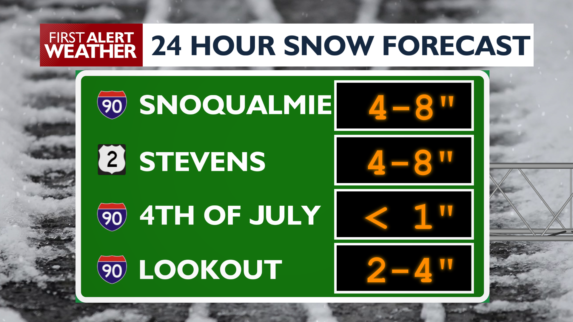
Snow levels will be dropping throughout the day, leading to accumulations for most mountain passes. Snoqualmie and Stevens Passes will end up with 4-8″ of accumulation by mid-morning on Thursday.
What We’re Tracking
Mountain snow will be the biggest weather hassle on Thursday. Valley and lowland rain showers will be light and occasional at best. Temperatures will continue to be much cooler than recent days. The next stronger system comes Sunday and Monday with more mountain snow and gusty valley winds.
Extended Forecast
COPYRIGHT 2026 BY KXLY. ALL RIGHTS RESERVED. THIS MATERIAL MAY NOT BE PUBLISHED, BROADCAST, REWRITTEN OR REDISTRIBUTED.