Monday brings unseasonable warmth before a strong cold front arrives Tuesday with powerful wind gusts and cooler temperatures.
Plan Your Monday
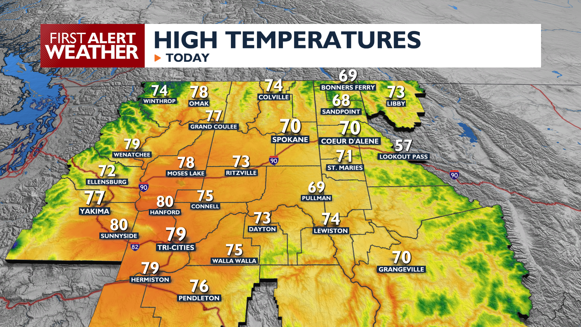
Monday will be the warmest day of the week with highs in the upper 60s to 70s and even some lower 80s in the Columbia Basin. That makes it the warmest day since early October! Clouds increase Monday afternoon as southwest winds begin to gust above 20 mph at times. An isolated shower is possible in our region this evening and overnight, but overall rain chances are very low, under 20%.
What We’re Tracking
A cold front Tuesday morning brings much cooler air and significant wind. Expect widespread gusts of 25 to 40 mph, with potential for 60 mph gusts near the Blue Mountains. These winds, combined with very low humidity, will create elevated grass fire potential Tuesday afternoon. Hold off on outdoor burning until Wednesday. Temperatures will drop 10 to 15 degrees compared to Monday, with highs only reaching the 50s and mid-60s. Dry and mild weather continues for the rest of the week as we warm up to the 60s again by Friday.
Extended Forecast
COPYRIGHT 2026 BY KXLY. ALL RIGHTS RESERVED. THIS MATERIAL MAY NOT BE PUBLISHED, BROADCAST, REWRITTEN OR REDISTRIBUTED.