It will be a cold start today with rain and snow showers in the forecast, followed by a steady warming and drying trend through Monday.
Plan Your Thursday
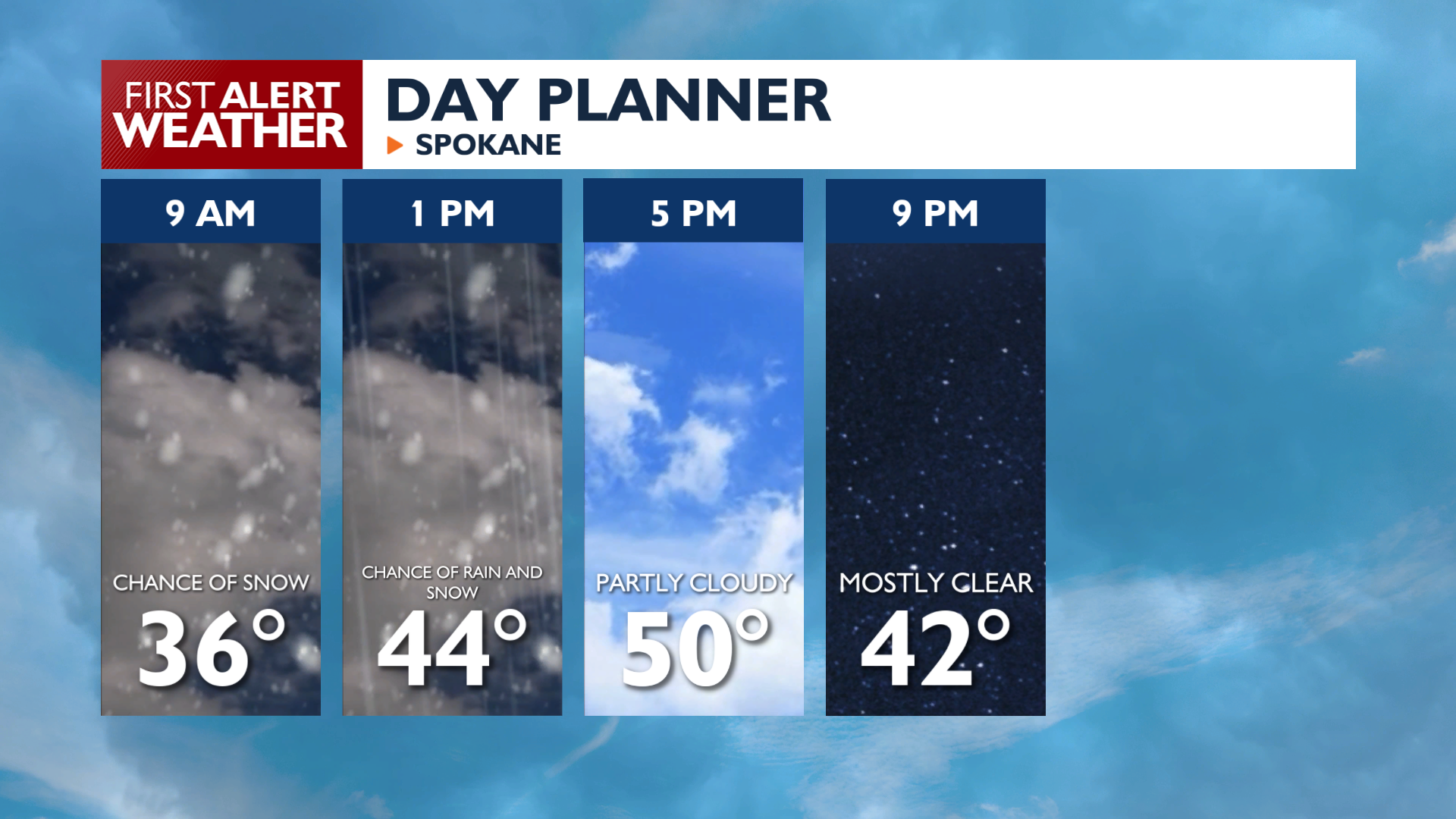
It will be a cold morning, and a little bit of blustery wind will add to the chill in the air. A Freeze Warning remains in effect for the Wenatchee area and Columbia Basin until 8 AM Thursday. Highs will struggle to reach 50 degrees in Spokane and are unlikely to get past 45 in many parts of North Idaho.
Snow showers near the Canada border will drop down towards the I-90 corridor mid-morning. Any showers before lunchtime are almost certain to fall as snow. Afternoon showers will be more of a winter mix. Wet weather will be more likely in the Idaho Panhandle south of I-90 than further west or north this afternoon.
Thursday Night will be another chilly one with lows dropping back into the upper 20s and low 30s, so protect any sensitive plants.
What We’re Tracking
A high-pressure ridge builds in starting Friday, bringing lighter winds and a noticeable warming trend. The warm-up will be quick. Temperatures will climb roughly 5 to 7 degrees each day through Monday. By Sunday and Monday, afternoon highs will reach the 60s and even low 70s under partly cloudy skies. The next chance for unsettled weather arrives Tuesday and Wednesday in the form of light rain showers and slightly cooler temperatures.
Extended Forecast
COPYRIGHT 2026 BY KXLY. ALL RIGHTS RESERVED. THIS MATERIAL MAY NOT BE PUBLISHED, BROADCAST, REWRITTEN OR REDISTRIBUTED.