Temperatures will stay on the cold side of average today while we see the occasional snow shower. Snow activity increases this evening, which could slick up the roads again into Friday morning.
Plan Your Thursday
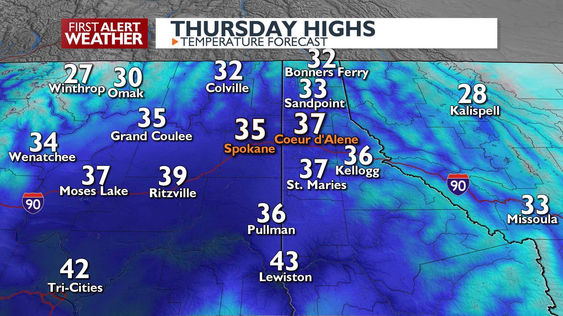
Highs will pull up into the mid-30s in the afternoon, but it will take a while. Light spotty snow is possible throughout the day region-wide while heavier showers continue in the northern mountains and valleys.
This area of snow will be on the move during the evening, sweeping into the Spokane and Coeur d’Alene area. Light snow accumulations are likely from mid-evening into early Friday morning of up to 2 inches.
What We’re Tracking
The snow across the region tonight will be the last notable round of precipitation until the end of the weekend. The occasional snow shower will still be possible during the day on Friday, but the weather will be more impactful as far as cold temperatures. Expect teens and low 20s for lows Friday and Saturday morning with a few single-digit readings near the Canada border. Temperatures moderate quickly starting Saturday afternoon and will be warm enough for rain come Sunday evening when wet weather starts up again. Next week will start out wet with a soggy, rainy Monday for the valleys.
Extended Forecast
COPYRIGHT 2025 BY KXLY. ALL RIGHTS RESERVED. THIS MATERIAL MAY NOT BE PUBLISHED, BROADCAST, REWRITTEN OR REDISTRIBUTED.