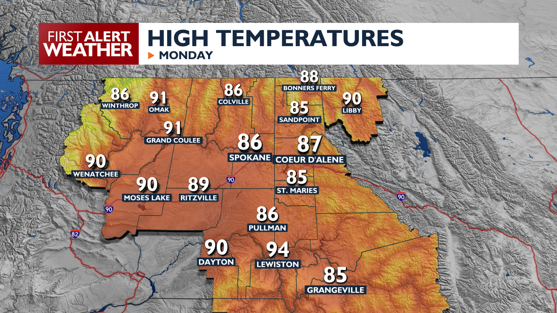
Temperatures will be cooler than last week, but smoky air remains as we continue to feel the impact of local and regional wildfires.
Plan Your Monday
Expect to see elevated areas of smoke throughout the day from fires burning in Eastern Oregon. Some of that smoke will get down into our breathing space this evening, leading to a drop in air quality after 4 p.m. in the Spokane and Coeur d’Alene area. High temperatures today will continue to be average to slightly below average. It will get a little breezy this afternoon with wind gusts up to 20 mph and up to 30 in the Columbia Basin.
What We’re Tracking
Winds pick up even more on Tuesday afternoon, raising fire danger late in the day. Temperatures gradually warm into the weekend, when another dry front will arrive with strong gusty winds. Rain remains hard to find in the forecast, with chances under 5% through the end of the week.
Extended Forecast
COPYRIGHT 2026 BY KXLY. ALL RIGHTS RESERVED. THIS MATERIAL MAY NOT BE PUBLISHED, BROADCAST, REWRITTEN OR REDISTRIBUTED.