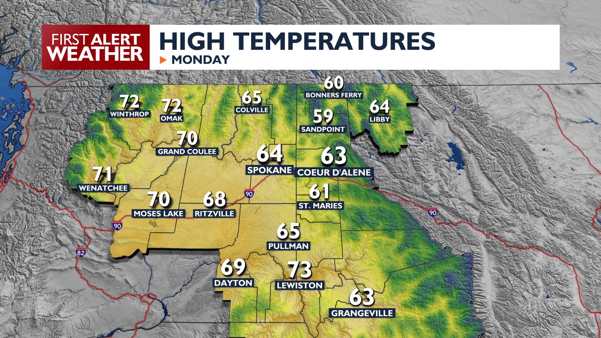
Expect a crisp early fall day across the Inland Northwest as we head into a calmer week of weather.
Areas of fog will slow you down on the roads this morning, especially in the Columbia Basin where a Dense Fog Advisory is in effect. Fog will lift and sunshine will return late this morning.
Monday features highs nearly 10 degrees below normal, ranging from the upper 40s and low 50s in the mountains to the 60s in the valleys. We are trending toward dry weather after the rain this weekend, but some scattered showers will linger over the Idaho Panhandle this morning. A few showers are also possible in the afternoon near the International Border.
On Tuesday, another system pays us a brief visit and brings a chance for light rain to Central and Northeast Washington, with amounts generally under a tenth of an inch. A significant warming trend begins Wednesday, which will bring us sunny skies and significantly warmer weather. Highs will be in the 70s heading into the weekend, with some areas in the 80s possible.
COPYRIGHT 2026 BY KXLY. ALL RIGHTS RESERVED. THIS MATERIAL MAY NOT BE PUBLISHED, BROADCAST, REWRITTEN OR REDISTRIBUTED.